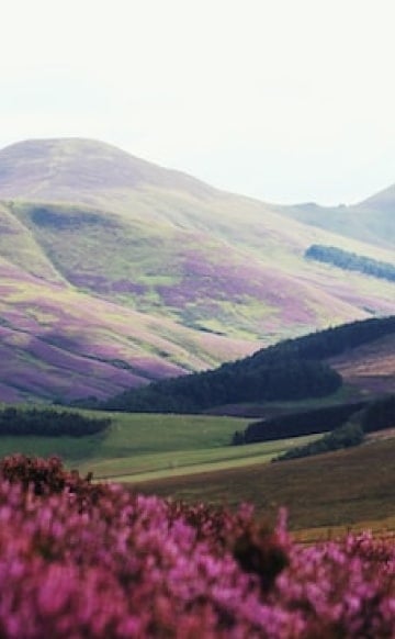
Ireland is famous for its picture-perfect scenes with everything from towering heather-covered mountains to magical coastlines with secluded sandy beaches. While exploring museums and spending evenings in a lively pub is a great way to spend your time in the Emerland Isle, with so many natural wonders, plan on capturing lots of photos of the incredibly scenic outdoors too. These are the very best to include on any itinerary here.

Cliffs of Moher
One of Ireland’s must-visit sights, the Cliffs of Moher in County Clare tower more than 700 feet over the Atlantic, stretching along the coast for five miles. Enjoy one of the world’s most stunning cliff walks, with views on a clear day of Galway Bay, the Aran Islands and the Twelve Pins mountain range in the distance. If you can, aim to be here just before dusk to take in the beauty with a colorful backdrop as the sun sets below the sea.

Powerscourt Waterfall
Just a 20-minute scenic drive from Lough Tay is Powerscourt Waterfall, Ireland’s highest, spilling 400 feet from the River Dargle near Enniskerry, tucked among picturesque parkland at the foothills of the Wicklow Mountains. It’s a great spot to picnic and watch for wildlife too, including Sika Deer. There’s also a scenic walking trail that surrounds the waterfall, providing views from various vantage points along the 30-minute trek. Along with Lough Tay, this is also part of “Excalibur Drive” which leads to multiple other locations where scenes from the movie were filmed.

Giant's Causeway
Science and mythology mingle at Giant’s Causeway along the Causeway Coast in Northern Ireland. A top attraction in Northern Ireland, it’s made up of some 40,000 basalt columns; it’s a true geological wonder and one of the most popular destinations on the island. Legend has it that it was carved out by the mighty giant Finn McCool who left his ancient home behind to battle his enemy across the sea in Scotland. You’ll see many other sites testifying to the myth, like The Camel, The Organ, The Wishing Chair, Giant’s Boot and Giant’s Granny.

The Burren
While it may seem like a stark, barren place with the landscape covered in pale grey stone laced with crags and crevices, The Burren is renowned for its diversity of flora and fauna, with a microcosm of the country’s wildlife along with Arctic-alpine plants that thrive, growing next to others that are normally found in the Mediterranean. There are a number of species that are rare elsewhere on the planet, yet they’re abundant here, all managing to survive in a place that seems to be nearly entirely made up of rock. Visits can also see the Poulnabrone dolmen, a portal tomb that’s name translates to “the hole of sorrows.” It dates back to the Neolithic period, sometime between 4200 BC and 2900 BC.

The Skellig Islands
The Skellig Islands are two small rocky islands located off the County Kerry coast, famous for their thriving puffin and gannet populations, along with an early Christian monastery which sits atop Skellig Michael, the larger of the two. Built by monks between the 6th and 8th centuries, it was can be accessed by a boat tour from Portmagee to see beehive huts, grave slabs, crosses and settlement remain. Small Skellig, the second peak, is inaccessible, serving as the world’s second-largest colony of gannets.

Slieve League, Donegal
The Slieve League cliffs are some of the highest sea cliffs in all of Europe, set along the northwest coast in Donegal. At the highest point, there’s almost a 2,000-foot drop separating the edge from the Atlantic. On a clear day, you can see the Ben Bulben Mountains in Leitrim and Sligo along with the endless expanse of the bright blue sea. This was also a place of Christian pilgrimage and a sacred place even before the Christians arrived. You can learn more about the cliffs at the Slieve Liag Cliffs Centre which also offers food, drink and crafts for sale.

Doolin Cave
Doolin Cave is the most well-known cave in Ireland as it houses one of the longest free-hanging stalactites in the Northern Hemisphere. Suspended from the ceiling like a chandelier, the 23-foot-long Great Stalactite formed from just a single drop of water over thousands of years. The cave was discovered in 1952 and has been a popular attraction since opening as a show cave in 2006. A guided tour will provide a 360-degree view of the formation as well as a look at the second cave chamber where you can see fossilized remains of sea creatures, straw stalactites, pillars and more.

Sally Gap, Wicklow National Park
Nestled in Wicklow National Park, Sally Gap lies deep within dramatic mountains, home to the sapphire waters of Lough Tay (a filming site for the History Channel series “Vikings” and the 1981 movie “Excalibur”), Glenmacnass Waterfall and Glencree Valley. There are a number of walks here that will bring you through the impressive scenery while surrounded by the Wicklow Mountains, including the Lough Dan walk which leads, as the name belies, to Lough Dan. Sally Gap Drive is a great way to do it too. Start in the village of Roundwood and make your way to the Lough Tay Viewing Point, marked on Google Maps.

The Dark Hedges
This magnificent avenue of ancient beech trees is one of the photographed places in all of Ireland. A short drive from the Causeway Coast, the trees were planted by the Stuart family in the 18th century, with the intention to impress visitors as they approached the entrance to Gracehill House, their Georgian mansion. A unique stretch of trees, it became famous after being spotlighted in “Game of Thrones,” when Arya Stark escapes King’s Landing with the latest recruits heading for The Wall. Arrive early to capture a photo without tourist crowds.

The Rainbows
No matter where you go in Ireland, you’re bound to see plenty of colorful rainbows in the sky. That’s because the weather is frequently under the influence of low pressure that’s linked to rising air that results in sunshine and showers. They’re even more common in spring and fall when the sun is low in the sky, bringing the perfect opportunity to chase them, and maybe even find that pot of gold at the other end. Or at least a pint of Guinness.

Croagh Patrick
The conical shape of Croagh Patrick towers more than 2,500 feet over Clew Bay and the landscape in County Mayo and is considered an important site of pilgrimage. Considered the holiest mountain in all of Ireland, it was named after the country’s patron saint, Saint Patrick, who is said to have fasted and prayed for 40 days at its summit during the 5th century. Every year on Reek Sunday, the last Sunday of July, thousands climb it, many who are barefoot, to reach the chapel at the top where mass is celebrated and confessions are heard.

Killarney Lakes
Another popular destination on Ireland itineraries, Killarney Lakes include three famously beautiful lakes, Upper Lake, Muckross and the lower lake, Lough Leane. Surrounded by rugged mountains in Killarney National Park, their beauty has long been celebrated through poems and songs. The scene, with woodland, lakes, mountains and waterfalls is surreal. There are trails to hike, a magnificently restored castle to visit and even uninhabited islands to paddle out to. Insifallen is an islet that can be accessed by rowboat and is home to the remains of an abbey where The Annals of Inisfallen, a chronicle of Irish and global history, was written by monks between the 10th and 14th centuries.

Gap of Dunloe
A narrow mountain pass carved between MacGillycuddy Reeks and Purple Mountain by glacial flow, the Gap of Dunloe is one of most scenic places in all of Ireland for a hike or a drive. The road meanders through the pass, descending into the Black Valley passing five lakes, including Black Lake, Coosaun Lough, Auger Lake, Black Lough and Cushnavally Lake. A short walk from Kate Kearney’s cottage is the “Wishing Bridge,” a pretty bridge where legend tells wishes really do come true. For an especially unforgettable experience, hop on a horse-drawn wagon to travel through the Gap to Lord Brandon’s cottage to take a boat back to Killarney.

Dingle Peninsula
The Dingle Peninsula is what many imagine when envisioning Ireland. Located in the southwest, it’s considered the most stunning stretch of coastline, with lush green hills and mountains dotted with thatched white-washed cottages and sheep, while dramatic cliffs touch down to the turquoise waters of the Atlantic. Slea Head Drive, which begins and ends in Dingle, will reveal the jaw-dropping views, chapels, ring forts, beehive huts and hidden sandy coves.

Cathedral Rocks, Blasket Islands
The Cathedral Rocks are located on Inis na Bró, part of the Blasket Islands which lie just off the Dingle Peninsula. These spectacular rock formations on its northeast point are a true natural wonder, named for its shape which resembles the outline of a massive Gothic cathedral. For years they were only known to sailors and fishermen, but today, visitors can take a tour around the seven islands in the Blasket archipelago to see the rocks along with other interesting features like ancient ruins, a lighthouse and perhaps deer. A herd of native red deer was successfully introduced to Inishvickillaun in 1980, with a stag and doe brought over from Killarney National Park.

